



Hi! I'm Ernestinho Carioc-IA. I can help you find the Rio guide you need. Where should we start?
OUTDOORS AND SCENERY
Nature in Rio
I’ll take you through Rio’s viewpoints, forests, trails, waterfalls and the landscapes of the West Zone. Choose a place and I’ll tell you how I would experience it.
Before setting out, check the weather, visibility, hours, access and notices with the relevant park authority. A general guide does not guarantee that a trail or sector is open that day. Plan your return on mountain routes and do not set out unprepared.
Viewpoints
Views that also help explain Rio’s geography. Cloud cover and access conditions can change the experience.
 Horto · Serra da Carioca
Vista Chinesa
A historic pavilion between the forest and views of the lagoon, Ipanema, Leblon and Dois Irmãos. I always check visibility and access before heading up.
 Horto · Serra da Carioca
Mesa do Imperador
A pause for stone, history and Atlantic Forest on the same road as Vista Chinesa. I explain what to look for and how to plan a visit.
 Serra da Carioca · Tijuca National Park
Mirante Dona Marta
A panorama for spotting Corcovado, Guanabara Bay, Sugarloaf Mountain and the lagoon. I would start by checking the sky and taking in the scenery at an easy pace.
 Realengo · Pedra Branca
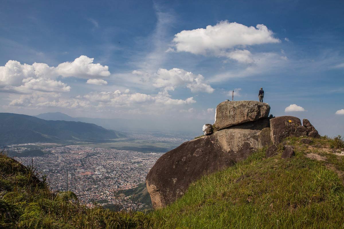
Mirante da Piraquara
A window onto the West Zone: Realengo in front and Serra do Mendanha beyond. The guide distinguishes the viewpoint from the full Transcarioca section.
 Rio da Prata · Pedra Branca
Mirante da Mesa
A viewpoint linked to Rio da Prata’s rural landscape and territory. A visit requires confirmation of community access and local guidance.
 Rio da Prata · Pedra Branca
Alto da Capelinha
A high point on Section 04 where forest and rural landscape meet. The guide separates traverse figures from access to the viewpoint itself.
 Rio da Prata · Pedra Branca
Alto da Bela Vista
A natural viewpoint for reading the landscape between the coast, forest and Campo Grande. Published figures refer to the full Section 04.
 Recreio · Zona Oeste
Pedra do Pontal
A short climb with a broad view of the western coast; check the terrain and access before setting out.
 Prainha · Recreio
Mirante do Caeté
A forest walk with views of the western coast. On weekends, confirm registration and availability before setting out.
 Horto · Serra da Carioca
Mirante do Horto
A viewpoint on a trail between Cachoeira da Gruta and Cachoeira dos Primatas.
 Tijuca Forest
Mirante do Excelsior
A view earned on foot. The Park publishes the latest time to start the trail and return in daylight.
 Tijuca Forest
Mirante da Cascatinha
A renovated deck for taking in Cascatinha Taunay and the mountains of the Floresta sector.
 Tijuca Forest
Vista do Almirante
A panorama toward Pedra da Gávea, Pedra Bonita and Agulinha. The specific access point still needs confirmation.
Pedra Branca and the West Zone
A large mountain range with access points spread across several neighborhoods. I plan by park sector and trailhead, rather than treating it as one entrance.
 Campo Grande · Taquara · Camorim · Realengo · Vargem Grande
Pedra Branca State Park
My guide to choosing a sector, understanding its park bases and planning a visit to the Atlantic Forest, with a special look at Rio da Prata and Campo Grande.
 Campo Grande · Zona Oeste
Rio da Prata and Campo Grande
A look at rural landscapes and access points, with the Transcarioca Trail explained by difficulty, duration and planning.
 Rio da Prata · Campo Grande
Jequitibá Centenário
A natural heritage landmark connected to the rural landscape. The guide distinguishes its local name from the Transcarioca’s bicentennial jequitibá reference.
 Pedra Branca Massif · Transcarioca Trail
Casa Amarela
A former Engenho Santa Bárbara house that now links mountain trail sections. Published distances and times refer to full routes.
 Jacarepaguá · Camorim access
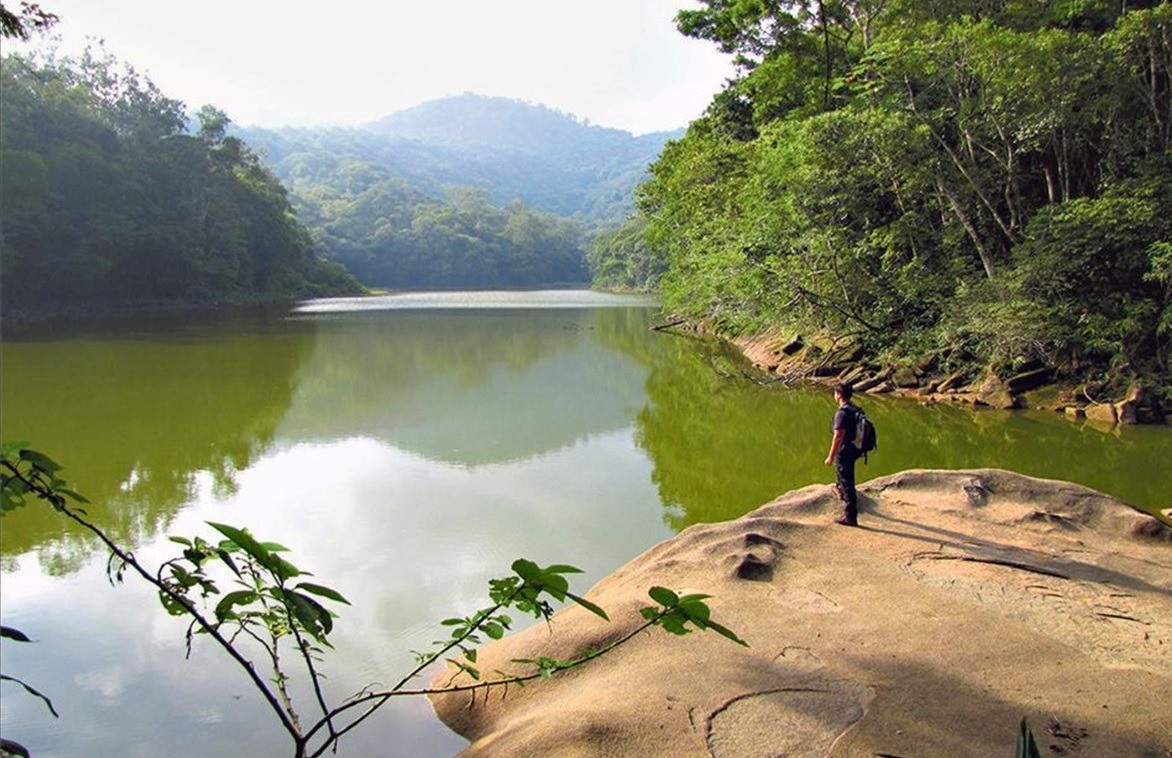
Camorim Park Centre
A gateway to the Atlantic Forest and water history, with a trail to the reservoir. I’ll tell you what to check before heading uphill.
 Casa Amarela → Pau da Fome · traverse
Transcarioca · Section 06
A reference 13.4 km and roughly six hours through forest, reservoir and heritage. A long outing with high difficulty and partial signage.
 Taquara · sede y visitantes
Pau da Fome Park Centre
A park gateway to explore the exhibition, check notices and decide whether the day calls for a hike.
 Pau da Fome → Piraquara · travesía
Transcarioca · Section 07
11.7 km and roughly six hours between two park centres. High difficulty, difficult navigation and return logistics to arrange.
 Maciço da Pedra Branca · cumbre
Pico da Pedra Branca
Rio’s highest point, with a published elevation of 1,024–1,025 m. Verify the specific route before planning a climb.
 Piraquara · patrimonio hídrico
Aqueduto do Barata Aqueduct
A water structure recognised on the Transcarioca. I share its context and how to view it without climbing.
 Camorim · patrimonio hídrico
Açude do Camorim Reservoir
A 1908 reservoir among the mountains. Swimming is prohibited and the water is not potable; enjoy it from the shore.
 Camorim · cascada y bosque
Cachoeira do Camorim Waterfall
A waterfall in the park with changing water flow. I do not assume swimming is allowed; check rainfall and rules before setting out.
 Camorim · montaña y memoria
Pedra do Quilombo Peak
A peak linked to Section 06. I share its landscape and context while being clear that independent access still needs verification.
 Camorim · Circuito das Águas
Cachoeira Véu da Noiva Waterfall
Water and hydraulic heritage in the forest. I explain what is known about the circuit and what still needs checking about swimming.
 Taquara · patrimonio hídrico
Aqueduto do Pau da Fome Aqueduct
A structure among the trees that helps us read the relationship between water, mountain and city. Its date and independent access still need confirmation.
 Realengo · northern gateway to Pedra Branca
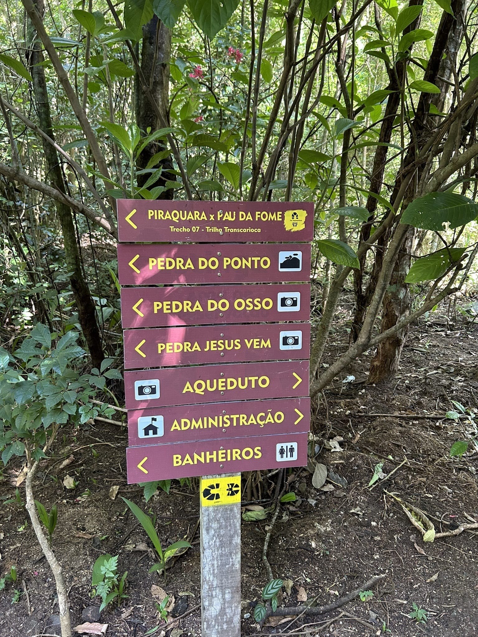
Núcleo Piraquara
A day of forest, history, water and trails. I explain the hours, access and how to choose a plan for the weather.
 Campo Grande · gateway to Rio da Prata
Rio da Prata Park Centre
INEA’s reference point for reaching this area and planning a walk in Pedra Branca.
 Morgado → Rio da Prata · long hike
Transcarioca · Section 04
An 11.5 km, roughly seven-hour traverse through mountains and rural landscapes, requiring navigation and return logistics.
 Piraquara · Pedra Rachada
Transcarioca · Section 08
A moderate trail with an important current recommendation: hike out and back from Piraquara to Pedra Rachada.
 Patrimonio hídrico · Realengo
Piraquara Aqueduct
A story of water, forest and engineering; distinguish the 34 km system from the Governador recreational section.
 Serra de Bangu · 932 m
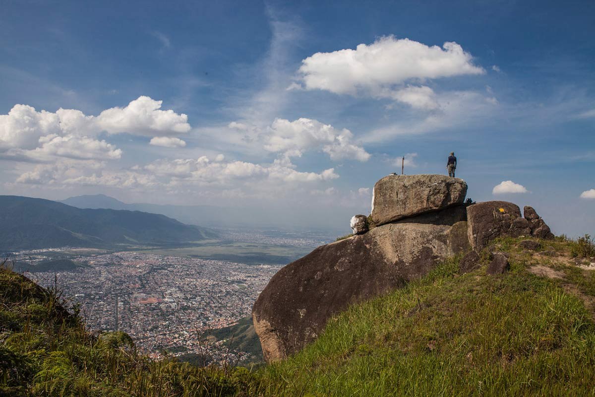
Pedra do Ponto
A summit with its own name and route. The photo shows the route, not the summit itself.
 Realengo · montaña
Pico do Piraquara
A summit distinct from Pedra do Ponto; access and navigation require a verified track and experience.
 Piraquara · agua y Mata Atlántica
Cachoeira do Barata
The waterfall INEA lists as open for swimming; check rainfall, water flow and current notices before entering.
 Piraquara · rock and forest circuit
Pedra Jesus Vem Circuit
The circuit material lists 3.7 km and about three hours; the access sign marks 3.7 km to Jesus Vem without saying whether that is one way or the full distance. The final section requires a separate decision.
 Serra do Barata · Piraquara
Pedra Jesus Vem
A rock formation at 520 m, linked to a historic inscription and a final section whose cable needs current confirmation.
 Piraquara · geología
Pedra do Osso
A distinctive monolith to view from the trail without climbing or disturbing the rock.
 Piraquara · pared rocosa
Muro das Lamentações
A large rock wall within the circuit. The guide prioritizes safe viewing and respect for climbing activity.
 Transcarioca Trail · Section 08
Pedra Rachada
A boulder split in two. Transcarioca recommends returning to Piraquara from here; check alerts and trail conditions.
 Barra de Guaratiba · West Zone
Sítio Roberto Burle Marx
A cultural landscape and botanical garden that requires advance planning and a guided visit reservation.
 Barra de Guaratiba
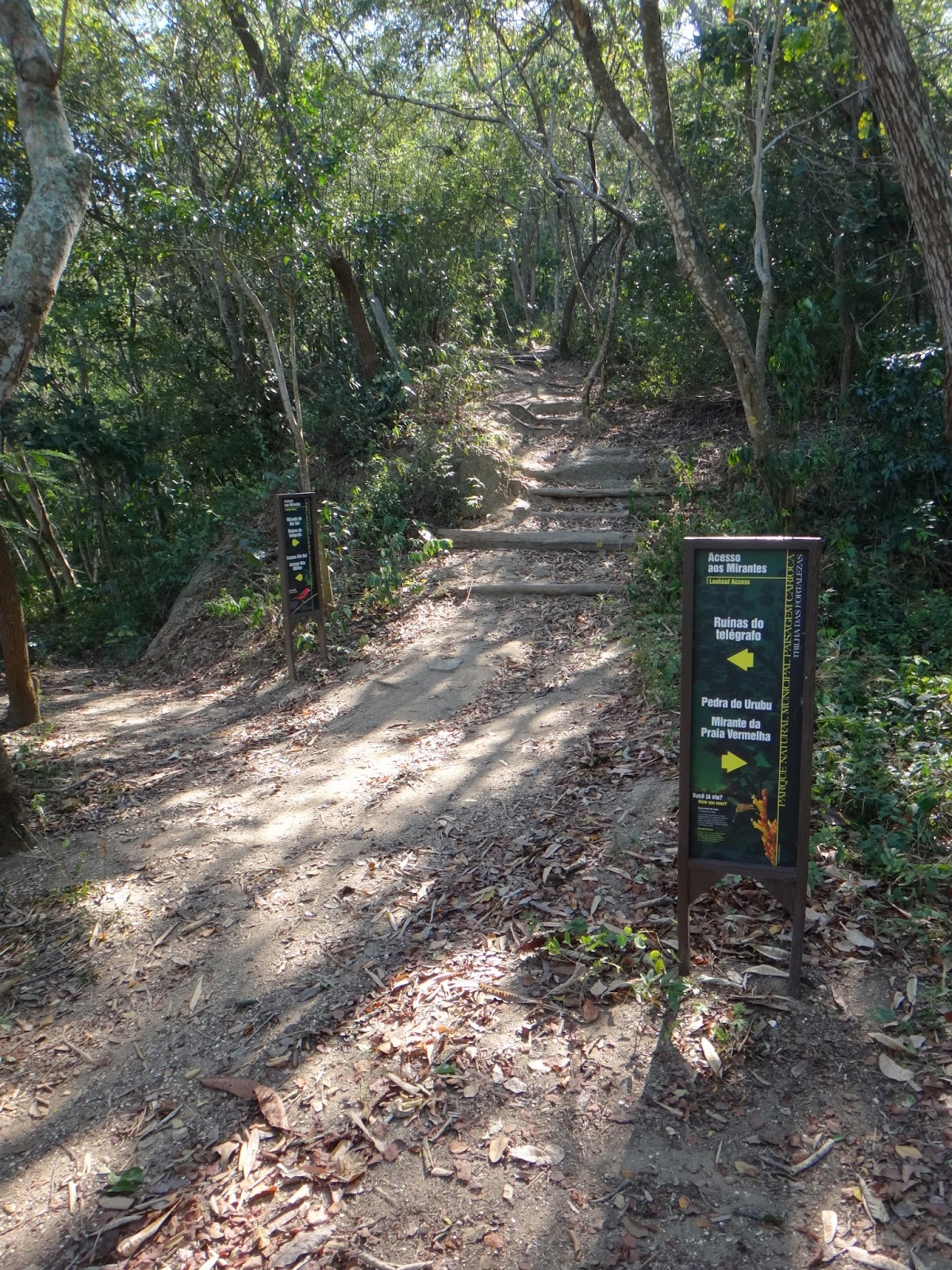
Pedra do Telégrafo
A walk with views of the wild beaches and coastline. Check trail conditions and local access.
Rural landscape and living memory
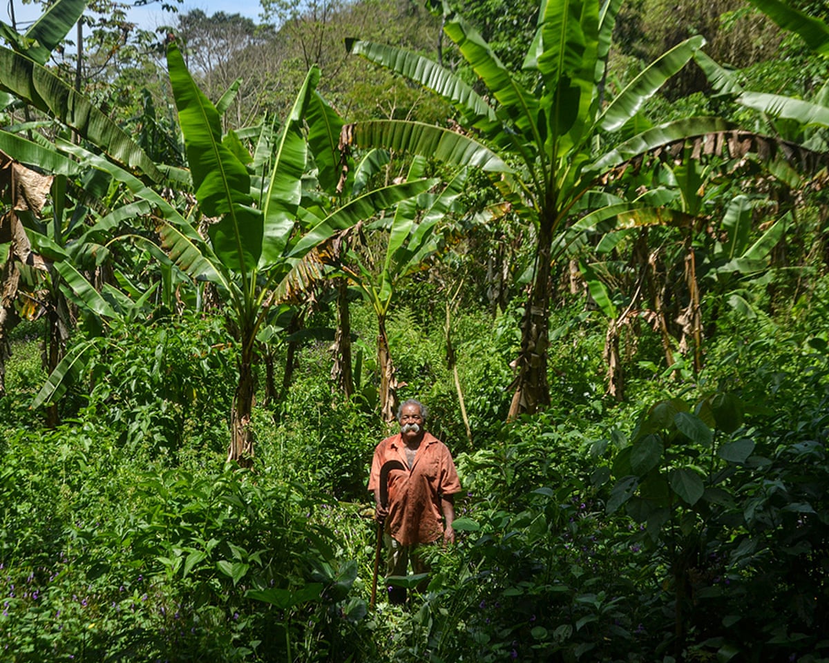
Pedra Branca’s natural landscape also holds stories of work, family and continuity. I tell them with respect: a community is not an attraction, and an agricultural path is not automatically a public trail.
 Historia · producción · territorio
Agriculture in the Pedra Branca Massif
A look at crops, paths and the relationships between families, forest, water and city, without inventing markets or access.
 Vargem Grande · memory and living culture
Quilombo Cafundá Astrogilda
A living community that deserves to be heard and respected. This page does not promise visits or publish internal access routes.
Water, engineering and landscape
The city’s water has a built history too. I connect aqueducts and canal bridges to the landscape and water supply, while distinguishing technical infrastructure from places open to visitors.
 History · infrastructure · water supply
The Guandu’s invisible water
An editorial overview of the water conveyance system and its milestones, without turning technical sites into visitor routes.
 Jardim Sulacap · since 1965
Aqueduto do Catonho Aqueduct
A visible part of a metropolitan water project, with its history and clear access boundaries.
 Sistema Guandu · patrimonio hídrico
Ponte da Cachoeira Canal Bridge
A roughly 164 m water conveyance structure; it is not a waterfall or swimming spot.
 Realengo · patrimonio hídrico
Ponte do Governo Canal Bridge
A canal bridge in the Guandu system, distinct from Rua do Governo, which leads to Piraquara.
Parks and gardens
Green spaces in and around the city, with outings to suit the time available and the pace of the day.
Prainha and Grumari
Two protected coastal landscapes that call for planning. I distinguish municipal parks, viewpoints and the Grumari APA; access and controls change by day.
 Prainha · Recreio · municipal park
Prainha Municipal Natural Park
Atlantic Forest, restinga and coast in a protected area of its own. Check hours, trails and access before setting out.
 Prainha · viewpoint to be confirmed
Prainha Viewpoint
I help distinguish the roadside reference from Mirante do Caeté and plan only a permitted, safe stop.
 Grumari · municipal park · West Zone
Grumari Municipal Natural Park
A mosaic of restinga, forest, wetlands and coast, with access and conditions to confirm.
 Grumari · coastal view to be verified
Grumari Viewpoint
A scenic reference associated with the coastal road. The guide flags what still needs confirmation about the location, stop and access.
 Grumari · conservación · contexto
Grumari Environmental Protection Area
A guide to the protected territory; it is not a recreational park or an independent entrance.
Guaratiba ecosystems and landscapes
Context guides to understand how mountain, water and coast connect. These are not routes through sensitive areas: each guide distinguishes public spaces and protected areas with their own rules.
 Grumari · ecosistema costero
Grumari Restinga
Learn to read this coastal vegetation and observe it from permitted public spaces.
 Geografía · cuencas · litoral oeste
Mountain and sea in Guaratiba
A connected view of forest, lowlands, wetlands, restinga, mangroves and bay.
 Neighborhood · coast · local life
Barra de Guaratiba
More than a trailhead: coastal nature, community, fishing and respectful planning.
 Neighborhood · Sepetiba Bay
Pedra de Guaratiba
A bay landscape with its own environmental identity and coastal history, distinct from Barra and Ilha.
 Ecosistema estuarino · conservación
Guaratiba mangroves
A brackish water forest to learn about from authorized viewpoints, never as a shortcut or informal trail.
Trails and walks
The official Transcarioca numbering goes from Section 21 to Section 23; this guide preserves that gap and does not invent a Section 22.
Mountain and forest routes with varying levels of effort. Check the guide and official conditions before choosing.
 Vidigal
Morro Dois Irmãos
A climb with views of Ipanema, Leblon, Rocinha, the lagoon and São Conrado. Plan access and your return carefully.
 São Conrado
Pedra Bonita
A popular hike with panoramic views of Pedra da Gávea, Barra and São Conrado.
 Barra da Tijuca
Pedra da Gávea
A long, demanding hike with a technical section. Plan it with a professional guide and suitable equipment.
 Tijuca Forest
Pico da Tijuca
A classic mountain destination in the forest, connected to sections of the Transcarioca Trail.
 Tijuca Forest
Bico do Papagaio
A hiking destination within Tijuca National Park; confirm access and conditions before setting out.
 Tijuca Forest
Circuito das Grutas
A route through greenery, rock formations and historic paths. Do not enter caves or leave the marked trail.
 Rio da Prata · Casa Amarela
Transcarioca Trail · Section 05
A demanding 8 km, roughly five-hour traverse through the massif, with a reference map and planning advice.
 Estrada dos Teixeiras · Trecho 09
Transcarioca Trail · Section 09
7.3 km and about five hours, with a discrepancy between the summary and technical listing to resolve before setting out.
 Tijuca Forest · Represa dos Ciganos
Transcarioca Trail · Section 11
A demanding 9.5 km route; the reservoir supplies water and swimming is prohibited.
 Bom Retiro · Visitor Center
Transcarioca Trail · Section 12
6.6 km and about four hours, with a scrambling climb towards Bico do Papagaio.
 Visitor Center · Portão da Floresta
Transcarioca Trail · Section 13
4.6 km of forest, viewpoints and cultural stops; check which services are open.
 Portão da Floresta · Mesa do Imperador
Transcarioca Trail · Section 14
A viewpoint trail with conflicting official metrics; plan for the longer estimate.
 Mesa do Imperador · Vista Chinesa
Transcarioca Trail · Section 15
A 1.6 km trail between two viewpoints; bring water and plan your return.
 Vista Chinesa · Dona Castorina
Transcarioca Trail · Section 16
3.5 km and about 2.5 hours; the optional Parque da Cidade circuit adds distance and time.
 Dona Castorina · Cachoeira dos Primatas
Transcarioca Trail · Section 17
3.9 km past waterfalls, a viewpoint and a century-old jequitibá tree; observe without touching or leaving the trail.
 Cachoeira dos Primatas · Paineiras
Transcarioca Trail · Section 18
4.2 km toward Paineiras, with high sun exposure and exit options to plan ahead.
 Paineiras · Parque Lage
Transcarioca Trail · Section 19
3.3 km with a scrambling section and high technical risk; watch the terrain and the section with traffic.
 Parque Lage · Lagoa · Catacumba
Transcarioca Trail · Section 20
An urban walk; the overview and technical sheet list different distances.
 Lagoa · Catacumba Municipal Natural Park
Transcarioca Trail · Section 21
A short circuit among outdoor sculptures, Atlantic Forest and the Sacopã and Urubu viewpoints.
 Copacabana · Parque da Chacrinha
Transcarioca Trail · Section 23
The current trail guidance recommends an out-and-back from the park to Morro São João; the original approach is unavailable.
 Leme · Morro da Babilônia
Transcarioca Trail · Section 24
A high-risk mountain route where a local guide is recommended; the guide distinguishes the circuit from the linear section.
 Urca · Praia Vermelha
Transcarioca Trail · Section 25
A 1.9 km climb to Morro da Urca; the hike and cable car have different hours and rules.
 MONA Cagarras · acceso marítimo
Transcarioca Trail · Section 26
Trilha da Comprida on Ilha Comprida: visits depend on protocols, sea conditions and authorized services.
 Rio da Prata · mountain trail
Engenho–Capelinha circuit
A documented circular route linking water and a viewpoint; its specific figures have not been published.
 Trecho 05 · Pedra Branca
Alto do Mangalarga
The section’s featured viewpoint, with views of massifs, bay and coast. Published figures refer to the full route.
 Trecho 05 · patrimonio
Calçamento histórico
Remnants of stone paths along the trail; their date and origin need heritage confirmation.
Water and coastal scenery
Waterfalls, forest and coastline appear in several parts of the city. Rain, surf, tides and local closures all factor into planning.
 Horto · Parque Nacional da Tijuca
Cachoeira dos Primatas
A waterfall surrounded by forest. Check whether access is open before going and stay out of the watercourse when it rains.
 Rio da Prata · Pedra Branca
Cachoeira do Engenho
A waterfall on the Trilha Transcarioca amid forest and rural roads. Confirm access and water conditions before setting out.
 Recreio · Zona Oeste
Pedra do Pontal
Sea and mountain meet on this coastal climb; choose your timing with the weather and terrain in mind.
Place, conservation and community life in Guaratiba
These guides add context to Guaratiba without turning neighborhoods, communities or protected areas into open access routes.
 Ilha de Guaratiba · West Zone
Ilha de Guaratiba
A place guide distinguishing the neighborhood, peri-urban landscape and protected areas without promising access.
 Guaratiba · conservação municipal
APA das Brisas
A guide to this protected area, distinct from a park with open visitor access.
 Guaratiba · Mata Atlántica y costa
Serra da Capoeira Grande Municipal Natural Park
Forest, restinga and mangroves in a municipal park; confirm opening and rules before walking.
 Manglar · bosque · costa
Birdwatching in Guaratiba
An invitation to watch birds without chasing them or entering restricted areas.
 Guaratiba · Sepetiba Bay
Artisanal fishing in Guaratiba
A view of fishing as work and living culture, with respect for local communities.