
Origin of the name
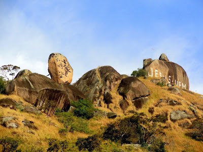
The park’s official guide links the name to an old inscription reading “Jesus Vem,” painted on the largest rock face in letters more than three meters tall. That reference explains the name used today. I found no source confirming who made the inscription, when or why, so I will not invent a story around it.
The formation’s published elevation is 520 m. This is an altitude figure, not hiking distance or a promise that the point is easy to reach.
The full circuit is the experience
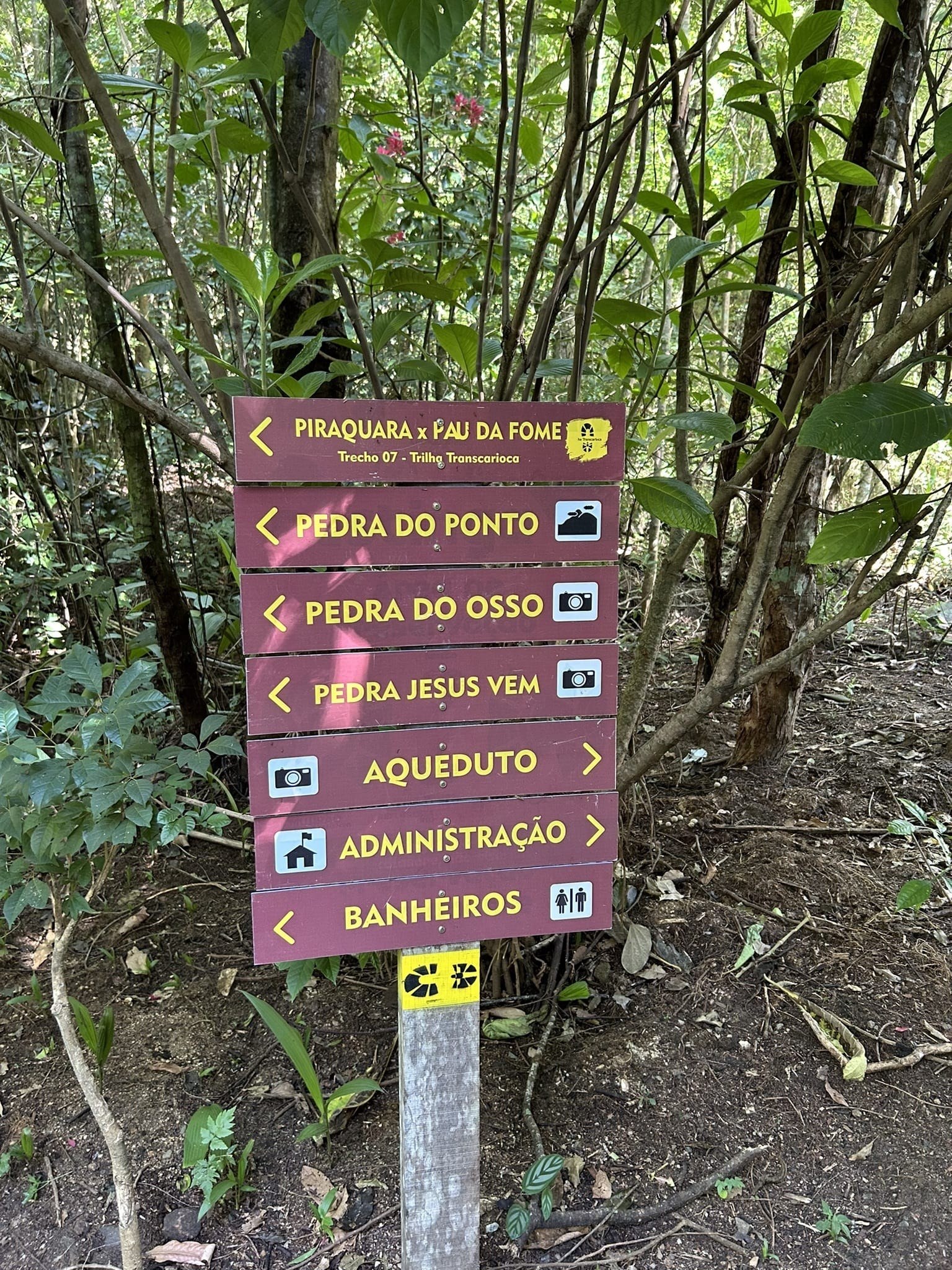
The park material consulted associates Circuito Pedra Jesus Vem with 3.7 km and about three hours, from roughly 95 m to a high point near 520 m. The sign photographed at Piraquara says “distance from the entrance to Pedra Jesus Vem: 3.7 km.” Since it does not clarify whether that is one way or the total, I do not describe the route as a loop or round trip. The route also connects Pedra do Osso and Muro das Lamentações.
My favorite part is seeing the scale change: forest and roots in some stretches, then huge cliffs and boulders when the terrain opens up. You do not have to climb every formation to enjoy the geology and scenery.
The final section requires a separate decision
The reference guide mentions an easy scrambling section with a steel cable to reach the high point. “Easy” in a guide does not mean it suits everyone: the passage involves rock, using your hands, exposure and possible vertigo. I could not verify whether the cable is installed or what condition it is in now.
I would ask the park before considering this climb, and would not attempt it on wet rock, in wind or a storm, or with vertigo or little experience on exposed terrain. I am not describing climbing or descent techniques. You can enjoy the circuit and choose not to climb; reaching the summit is not a requirement.
Hours and access
The general starting point is Núcleo Piraquara, at the end of Rua do Governo in Realengo. INEA lists park visiting hours Tuesday to Sunday, 8 am to 5 pm. For a three-hour circuit, I would plan to start between 8 and 9 am, leaving time for breaks and a return before closing. That window is my suggestion; the park does not publish a specific official start time for Jesus Vem.
Confirm that the site and route are open that day. Download offline maps and let someone know your plan. Do not add or transfer figures from other trails in the area to this hike.
What to bring and how to assess the outing
I would bring enough water, light food, grippy footwear, sun protection, insect repellent, a charged phone and power bank. Heat can be intense in Realengo, and open stretches have less shade. After rain, roots, mud, rock and cable lose traction; in extreme heat or a storm, postpone rather than rush.
I recommend this hike for people with moderate fitness and trail experience. I would not label it universally suitable for children: age, coordination, confidence on rock and the ability to turn back all matter. The full route is not wheelchair accessible. A local guide can help first-time visitors with navigation and reading the terrain.
Ernestinho's tip
Do not judge the outing by the number “3.7” alone. Consider elevation, rock, heat and the final passage, and decide in advance what you will do if the cable or terrain feels unsafe. I would rather return eager to come back than push through a section out of pride.
What to combine it with
This formation is part of the Pedra Jesus Vem Circuit. Before you go, you can also read the guides to Pedra do Osso y Muro das Lamentações. For a less demanding outing, see the guides to Núcleo Piraquara and Cachoeira do Barata; INEA identifies the latter as the park’s only waterfall open for swimming. Check conditions for the day.
Sources
INEA guide and information → · Section 08: attractions and access to the sector →
