
My take
This is not a quick roadside viewpoint. You need to enter the Floresta sector and walk through the forest. The climb, shade and change in temperature are part of the visit; the view at the end is a reward, not the only reason to go.
The walk according to the Park
Tijuca National Park’s website rates the trail as easy and estimates about an hour of walking. The guide does not clarify whether that is one way or the full route, so I allow more time for the hike out, time at the viewpoint and the return. The point is at the end of Estrada do Excelsior; you cannot drive all the way to the view.
The MD research file provisionally rates it as moderate effort because of the sustained climb. I use the Park’s easy rating as a general reference but also consider personal pace, heat, trail conditions and whether children or older visitors are with me. A published rating does not replace an individual assessment.
Hours and latest start time
The Park lists daily access from 8 am to 5 pm and says the trail must be started by 2 pm to allow visitors to return before closing. This cutoff organizes the day. I suggest starting early, taking the climb at an easy pace and leaving enough daylight for the descent.
How to get there
The Floresta sector entrance is at Praça Afonso Viseu in Alto da Boa Vista. The Park lists access via Estrada das Furnas from Barra/Itanhangá or Avenida Edson Passos from Tijuca. Published bus routes are 301, 302 and 345; confirm service and the stop location before setting out.
The map marks the Estrada do Excelsior corridor, not an exact hiking track. Use the Park’s GEO portal for orientation in the sector and check for closures or maintenance.
Name and landscape history
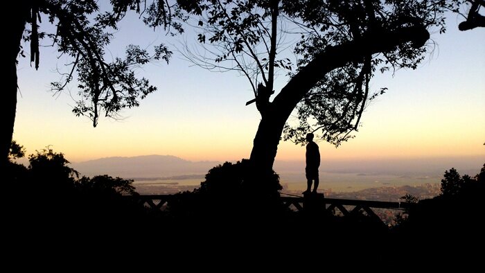
The Park website explains that “Excelsior” honors Henry Wadsworth Longfellow’s poem of the same name. The viewpoint opens onto a city view. Vegetation, clouds and weather affect what you can see, so I bring my camera but also enjoy the forest when the horizon is veiled.
What to bring and safety
Grippy shoes, water, insect repellent and a light layer for temperature changes are good basics. Bring an offline map and do not rely on mobile service. During rain, storms or after recent muddy conditions, I postpone the hike; wet rocks and roots slow the descent.
What to combine it with
Excelsior is in the Floresta sector with Cascatinha Taunay, Mirante da Cascatinha and other Park sites. You can plan a forest day around one of them, but check distances and times separately; do not assume they are all connected by a short walk.
Ernestinho's tip
My rule is to plan the return too. The start-time cutoff helps prevent people from descending late. If the morning runs behind, I would rather change plans than try to make up time on the mountain.
Sources and planning
Tijuca National Park: difficulty, time, hours and access → · GEO portal and Park map →
