
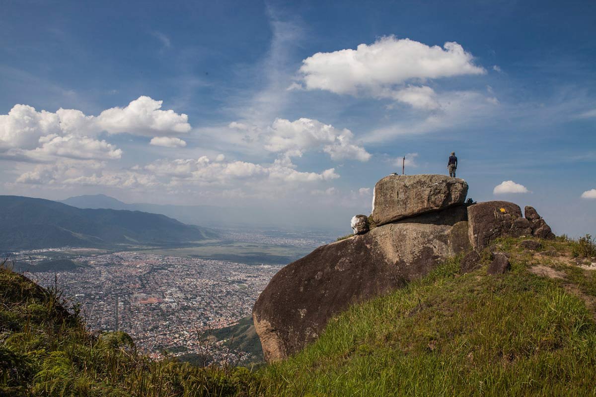
My take
I like Mirante da Piraquara because it shifts the focus. The bay and beaches do not dominate this landscape; the West Zone takes centre stage. Trilha Transcarioca identifies Realengo and Serra do Mendanha as visible landmarks. I would not add other neighbourhoods or mountains without reliable visual confirmation.
Do not confuse the viewpoint with the section
The viewpoint is associated with Section 08 of the Trilha Transcarioca; it is not the whole route. The official guide describes the Piraquara–Estrada dos Teixeiras section as 4.6 km, around three hours, moderate difficulty and partial signage. Those figures cover the full section: reliable figures for the viewpoint spur’s distance, duration and elevation gain are not published.
That is why I will not make up a time “from the entrance”. Trilha Transcarioca rates the section as low risk, with moderate sun exposure, easy orientation and water available, but only partial signage. The specific spur may change the effort and navigation. Download the official map and check with park staff or a local guide before setting out.
Hours and suggested time
INEA lists visits to Núcleo Piraquara during general park hours, Tuesday to Sunday, 8 am–5 pm. I suggest starting in the morning, allowing enough time to finish the outing in daylight; this is a planning tip, not a special schedule published by the Park.
I do not recommend starting the spur late in the afternoon, planning for sunrise without confirming access, or continuing in a storm or heavy rain. Recent rain can leave mud, wet roots and slippery rocks. This outing becomes a lower priority in intense heat, fog or poor visibility.
Planning access
The public access reference for this sector is Núcleo Piraquara on Rua do Governo in Realengo. Trilha Transcarioca publishes a Section 08 guide, a downloadable map and a tracklog; use these alongside current park information. The map on this page shows the access hub, not the precise viewpoint spur.
The Trilha Transcarioca guide also notes technical activities at other attractions on the section, such as Pedra “Jesus Vem”. Do not treat that as part of visiting the viewpoint or attempt a scramble without the required experience and equipment. Stay on the permitted route, log your outing if the park asks you to and carry an offline map.
What to bring and who it suits
I would recommend it to people with forest hiking experience who can navigate with incomplete signage. Bring enough water, grippy footwear, sun protection, a charged phone, a basic first-aid kit and an offline route. I do not classify it as family-friendly, suitable for older visitors or accessible until the spur, elevation gain and terrain have been assessed.
Ernestinho's tips
Before setting out, confirm the hub is open and check trail conditions; tell someone your planned route and expected return time. If there is heavy rain, a storm, wet terrain or poor visibility, I would change the plan. In an area with partial signage, carrying a map and leaving enough daylight matter more than ticking off every stop.
What to combine it with
The most logical connection is with Núcleo Piraquara itself and our guides to Pedra Branca, Realengo and Trilha Transcarioca. INEA lists recreation areas and Cachoeira do Barata as the park’s only waterfall cleared for bathing; check conditions for the day and do not assume other pools or waterways are open for swimming. I do not turn these connections into a detailed itinerary.
Map and planning information
The map shows general access to Núcleo Piraquara. For Section 08, consult Trilha Transcarioca’s map and tracklog; do not treat the section’s 4.6 km as the viewpoint spur’s distance.
