
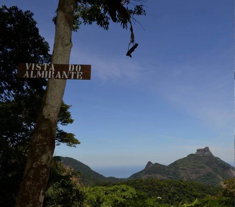
What it is and what you can see
Vista do Almirante appears in Tijuca National Park’s list of places in the Floresta sector. The official website confirms views toward Pedra da Gávea, Pedra Bonita, Agulinha and much of the sector itself. This guide’s photo shows the sign and mountain landscape; it helps identify the visual reference but does not replace a map.
My take
I like including lesser-known places when we can say precisely what they offer. Here, the appeal is clear: a viewpoint with a broad view of the massif. The public guide does not yet describe the specific access, so I will not market it as a “secret” or invent a trail.
Access and hours: details to confirm
The Floresta sector has general access from Praça Afonso Viseu, but that alone does not confirm how to reach this point. Before setting out, check the GEO portal or contact the Park to confirm it is open and learn the authorized route.
I suggest going during daylight with plenty of time, after confirming access. I do not recommend planning for sunrise, sunset or a night visit without published hours and a route.
How to plan the visit
Open the Park’s official map and look for the exact reference rather than relying only on a generic web search. If you cannot identify the authorized trail, go with an accredited guide or choose another point in the sector with better-documented access. Bring a charged phone, offline map, water and closed shoes, and tell someone your plan.
Visibility and weather
The reward is a panorama that fog and low clouds can obscure. I would check the sky and forecast before crossing the city. In rain, storms or waterlogged conditions, an unverified route is not a good one to improvise.
What to combine it with
Vista do Almirante and Mirante do Excelsior are in the Floresta sector, but I do not claim that access between them is immediate or that they form a short circuit. You can compare them when planning a Park visit and choose after checking maps, hours and conditions.
Ernestinho's tip
When the scenery sounds appealing but the route is unclear, I confirm the route first. A good guide should also say “this still needs to be checked” and help you choose a safe plan for the day.
Sources and planning
Tijuca National Park: Vista do Almirante and confirmed panorama → · GEO portal and Park locations →
