
My take
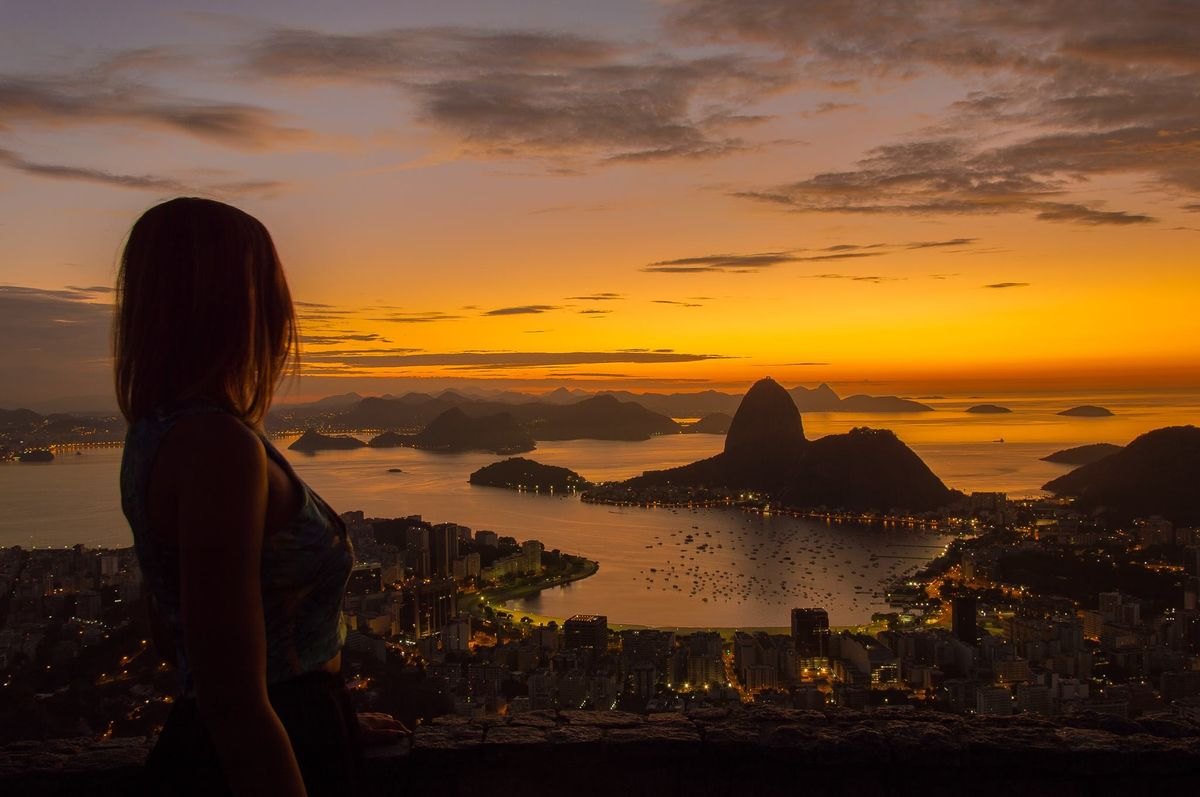
When I go up with someone visiting Rio for the first time, I do not ask them to take in everything at once. First we find Christ on Corcovado; then I follow the view towards Botafogo and Sugarloaf Mountain, the entrance to Guanabara Bay and Rodrigo de Freitas Lagoon. These landmarks show how the city fits between hills, forest, water and sea.
The viewpoint is in the Serra da Carioca sector of Tijuca National Park. Park documents place it at around 360 metres above sea level. Cloud and mist change the view: the same visit can reveal the city or hide parts of it.
What you can spot
On a clear day, you can spot Christ the Redeemer and Corcovado, Sugarloaf Mountain, Guanabara Bay and Rodrigo de Freitas Lagoon. Botafogo, Flamengo and the city’s varied terrain also come into view. I read the landscape in layers: mountains first, then water, then neighbourhoods. The photo becomes more than a postcard; it tells how Rio grew between forest, bay and sea.
The viewpoint sits about 360 metres above sea level in the Serra da Carioca sector of Tijuca National Park. It is a scenic stop, not a summit hike: the official park page lists it among the sector’s viewpoints. Clouds, rain, mist and backlighting can all affect the view, so I cannot promise clear skies even if the day starts sunny.
When to go and how much time to allow
The park’s official website lists daily opening hours from 8 am to 5 pm. For softer light and time to look around, I suggest arriving between 8 and 10 am; mid-afternoon can also work if you leave well before closing. These are editorial suggestions, not special viewpoint hours. I would not plan a sunset visit without confirming that day’s access and closing time.
Allow about 30–60 minutes at the viewpoint—my estimate for taking in the view, photos and bearings—plus travel time, traffic and any queues or checks. If the sky is overcast, check webcams, the forecast and park notices before going up. Sometimes the best Rio move is to change the order and return when the mountain clears.
Planning access
Use the map to reach the viewpoint by the vehicle access and check the route on the day. The official park information I consulted confirms the hours and location in Serra da Carioca, but does not list a public transport line I can safely recommend. If you use a ride app or taxi, plan your return; do not assume a car will be waiting at the top. The walk from Santa Marta community is a separate outing with its own conditions and local guidance. Do not confuse it with a regular viewpoint visit or start without checking access locally.
Ernestinho's tips
Bring water, sunscreen and comfortable shoes. Even for a short stop, you are in a natural area and exposed spots can feel hot. Stay in permitted areas, do not feed wildlife and carry your rubbish out. Mobile coverage can fail in parts of the park, so save your return point and route before leaving. I change plans during heavy rain, thunderstorms, slippery conditions or when clouds hide the city.
What to combine it with
I would pair it with Christ the Redeemer or Paineiras if access is confirmed and you have allowed for travel time. They are in the same broad Serra da Carioca sector, but each has its own checks, timing and logistics. A more urban option is to head down and continue to Santa Teresa or Flamengo. Choose one follow-up and leave a buffer; I would not link distant park sites as if they were one continuous walk.
Accessibility and facilities
This guide does not certify full accessibility. Check slopes, surfaces, resting points and available facilities with park staff before visiting, especially if anyone uses a wheelchair or needs walking support. Also ask about toilets, parking and temporary closures; I do not want to promise facilities that may change.
Before you go
The park’s general hours are daily from 8 am to 5 pm, subject to operational notices and temporary closures. Check the official channel on the day and do not stay beyond the stated hours. Mirante Dona Marta is within a protected area: remain in permitted spaces and follow park rules.
