
SunsetPedra do Arpoador
AREA · South ZoneBEST TIME · 45 minutes before sunsetACCESS · Free
Use Dois Irmãos as the backdrop and stay through blue hour.
Open map ↗
THE CITY THROUGH YOUR CAMERA
It is not only about where to take the photo: timing, light and how you get there can completely change the result.
Use Dois Irmãos as the backdrop and stay through blue hour.
Open map ↗
Frame Sugarloaf Mountain and Christ the Redeemer from the viewpoint's two levels.
Open map ↗
Go up early and photograph the city as the light changes.
Open map ↗
Use a wide-angle lens to include the monument, then look for views from the sides.
Open map ↗
From the courtyard, line up the pool, arches and Christ the Redeemer.
Open map ↗
Arrive early for fewer people and more even colors.
Open map ↗
Include the boats and reflections on the bay; keep your phone secure near the edge.
Open map ↗
Photograph the first light between the sea and the mountains.
Open map ↗
Use the outline of Ipanema, Arpoador and the sea as leading lines.
Open map ↗
Panoramic view over Ipanema, Lagoa and São Conrado; do not hike the trail alone.
Open map ↗
The side angle creates the illusion of height; respect the queue and the surroundings.
Open map ↗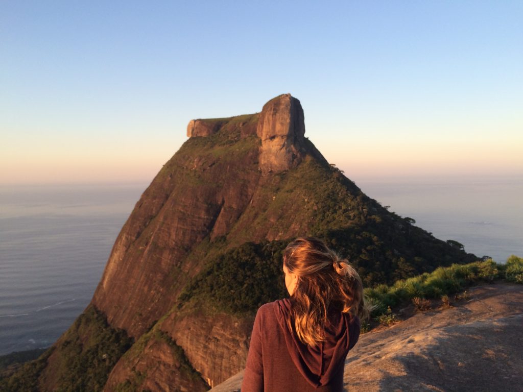
Wide panoramic view of Pedra da Gávea, Barra and São Conrado.
Open map ↗
Frame the city with the viewpoint's Chinese-style structure.
Open map ↗
Ideal for portraits surrounded by Atlantic Forest.
Open map ↗
A slower shutter speed softens the water; avoid wet rocks.
Open map ↗
Look for reflections and symmetry in the façade and reflecting pool.
Open map ↗
Step back to show the mural's scale, or use each face as a backdrop.
Open map ↗
Shoot a centered composition from the entrance and respect restricted areas.
Open map ↗
Use mirrors and stained glass to capture the depth of the hall.
Open map ↗
From Cinelândia, combine the illuminated façade with the movement of the square.
Open map ↗
Light streams through the stained glass; try a vertical shot from the center.
Open map ↗
Photograph from busy areas and avoid displaying equipment on empty streets.
Open map ↗
Include streets, tracks and historic houses; never step onto the tracks.
Open map ↗
Combine the building's arches with Downtown and the bay.
Open map ↗
Use the boats in the foreground with Sugarloaf Mountain in the background.
Open map ↗
Palm trees, the cycle path and the bay create depth; make the most of lively Sundays.
Open map ↗
Capture sporty silhouettes with Dois Irmãos and a warm sky.
Open map ↗
Get low to emphasize the mosaic and use the buildings to create perspective.
Open map ↗
From the point, capture the full curve of Copacabana.
Open map ↗
Check the tide: the strip of sand can disappear.
Open map ↗
Wild beach scenery; avoid leaving visible belongings in the car.
Open map ↗
Photograph the curves of the coastline from permitted areas.
Open map ↗
Houses, canals, boats and wildlife; ask permission before photographing residents.
Open map ↗
Use the museum's curves to frame Rio across the bay.
Open map ↗
Frame arches, fortress walls and Sugarloaf Mountain in alignment from the fort.
Open map ↗For drones, always check current ANAC rules and airspace authorization through SARPAS/DECEA. Airports, helipads, military areas, crowds and protected areas require special attention.


We plan your itinerary, or I join you on an exclusive private tour.
